Kaliningrad map
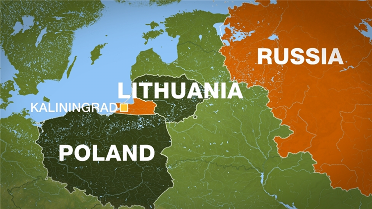
Kaliningrad Map: Comprehensive Guide to the Region's Geographic and Administrative Layout
Kaliningrad is an exclave of Russia, geographically isolated from the main part of the country. It is situated on the Baltic Sea, bordered by Poland to the south and Lithuania to the north and east. This unique positioning makes Kaliningrad a significant area in terms of geopolitics, culture, and economy. To understand the region better, one of the most essential tools is the Kaliningrad map, which provides a detailed view of its urban and rural areas, transportation networks, and administrative divisions.
Geographical Overview of Kaliningrad
Kaliningrad's location as a Russian exclave has made it a focal point of international relations. On a Kaliningrad map, the region’s boundaries stand out, especially its proximity to the European Union. With an area of approximately 15,100 square kilometers, Kaliningrad is relatively small, yet it holds strategic importance due to its access to the Baltic Sea.
-
Key features visible on the map:
-
Coastal areas: Kaliningrad's western boundary is formed by the Baltic Sea, offering port access.
-
Major rivers: The Pregolya and the Neman rivers are significant water bodies that cut through the region.
-
Urban centers: Kaliningrad city, the administrative capital, is located centrally along the Pregolya River.
-
Administrative Divisions on a Kaliningrad Map
Kaliningrad is divided into several administrative districts, each with its own characteristics. These are important to understand when analyzing the region on a map. The city of Kaliningrad itself is a federal subject of Russia, while the surrounding areas consist of municipal districts, including rural zones and smaller towns.
-
Municipalities:
-
The map reveals several districts such as Gusev, Baltiysk, Zelenogradsk, and Neman, each having different population densities and economic activities.
-
The most urbanized and developed area on the map is Kaliningrad city, which serves as the cultural and economic hub of the region.
-
Transport and Infrastructure in Kaliningrad
A well-constructed Kaliningrad map also highlights the region’s infrastructure, which plays a key role in connecting the exclave with other parts of Russia and Europe. Kaliningrad is well-equipped with road and rail networks, providing efficient transportation routes.
-
Key transport features:
-
Highways: Major highways like the A229 connect Kaliningrad city to Lithuania and Poland.
-
Railroads: The region has an extensive rail network, including connections to the broader Russian railway system, though some parts are isolated due to international borders.
-
Ports: Kaliningrad's port, located on the Baltic Sea, is marked prominently on the map. It is vital for both commercial trade and military purposes.
-
Natural Resources and Environmental Features
Kaliningrad is known for its diverse landscape, which includes forests, rivers, and coastal regions. The natural environment is a critical aspect of the Kaliningrad map, providing insights into the region’s biodiversity and potential for economic development in areas such as agriculture and tourism.
-
Forests and reserves: Kaliningrad is home to large forests, including the Kurshskaya Kosa, a narrow sandbar stretching along the coast.
-
Wetlands and rivers: The Neman River, as depicted on the map, is an important waterway that crosses into Lithuania, while the Pregolya provides access for shipping in the region.
Historical Significance of Kaliningrad on the Map
Kaliningrad has a rich and complex history that is reflected in its geographic layout. Originally part of East Prussia, the area was heavily influenced by German and later Soviet administrations. This historical background is an essential factor when studying the Kaliningrad map, as the region’s boundaries have shifted over time.
-
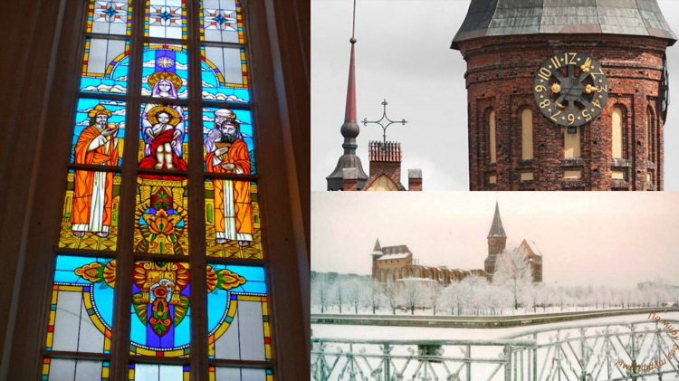
Historical landmarks: The Kaliningrad map marks key sites such as the Königsberg Cathedral and the Fortress of Königsberg, both of which hold cultural and historical value.
-
Post-WWII changes: Following the end of World War II, Kaliningrad became part of the Soviet Union, which significantly altered its demographic and cultural landscape.
Kaliningrad Map: A Tool for Tourists and Locals
For both residents and visitors, the Kaliningrad map is an indispensable resource. It provides a clear view of the region’s cities, historical landmarks, natural features, and transportation options. The detailed maps also assist tourists in navigating the area’s diverse attractions, from the Amber Museum in Kaliningrad city to the nature reserves along the coast.
-
Tourist attractions: The Kaliningrad region is home to several unique sites that can be easily located on a map, including:
-
Curonian Spit National Park
-
Kaliningrad Zoo
-
World War II museums and memorials
-
Frequently Asked Questions (FAQ)
What is Kaliningrad’s strategic importance on the map?
Kaliningrad holds a strategic location due to its position on the Baltic Sea and its proximity to the European Union. The region serves as a critical military and economic outpost for Russia.
How can a Kaliningrad map help tourists?
A detailed Kaliningrad map helps tourists locate key attractions, plan their routes, and understand the region’s infrastructure, making it easier to travel around the exclave.
What are the main transportation routes in Kaliningrad?
The main transportation routes in Kaliningrad include highways to Poland and Lithuania, an extensive rail system, and a major port on the Baltic Sea.
Is Kaliningrad connected to Russia by land?
Kaliningrad is geographically separated from the rest of Russia and is bordered by Poland and Lithuania, making direct land travel to other parts of Russia complicated.
What are the natural features visible on a Kaliningrad map?
Key natural features include the coastal areas along the Baltic Sea, the Curonian Spit, the Pregolya and Neman rivers, and vast forested areas.
